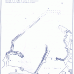
Pantelleria, the harbor and the island !
- Receptions:
- Years. 36° 47′ North – Long. 12° 59′ Is
- Maritime Authority:
- Local Office of Maritime Street S. Nicola, 1 – Such.0923/911027
- It includes 4 Whether quay length of about m. 75 the southern; m. 55 the one at W; m. 40 tract in the NW and m. 75 the stretch of quay per day of NNW. On the stretch of quay per day are anchored n. 2 floating docks of m. 50 of length.
- It features slipway, storage.
- Moorings
- about 150
- Circolo Vela
- Ladder Porto – Such. 916529.
- Chorography
- Description of the port
- Stretch of water: m. 158.000 with depths up to m 6.
- The port of Pantelleria consists of two basins:
- Porto Vecchio: located across the country and is bordered by a Levante Pier and Pier Nasi; is used as commercial transactions and stop for pleasure craft and small fishing boats. The docks measuring a total I. 1.120 of which 285 are operational. At the heart of the Old Port are the ruins of the Carthaginian Pier forming a line of rocks outcropping oriented to NE-SW, unreported and dangerous to navigation. The boulders are not removed because they offer protection to the quay of Borgo Italy.
- New Port: Located across the area known as Punta Cross. It is enclosed between the pier and the pier Nasi Cidonio, that is separated from Punta Cross, largely wharfed. We moor to stop the M / V of the Harbour, Carabinieri, the trawlers, pleasure craft, as well as the small ships of local shipowners. Includes:
- Quay: the length of m. 100 of which 85 operating, with depths of m. 0,4 a 2-4,5;
- Pier Nasi: (side Levante), the length of m. 410 of which 200 operating with depths of m. 4 a 6;
- New Quay Harbour: the length of m. 900 about almost all operating with depths of m. 3 a m. 7 in addition to n. 2 floating docks from 50 m.;
- Breakwater
- Anchor
- You can anchor a short distance from the breakwater. The fund, sand and rocks, is quite good holding. With clear weather and calm sea bottom is visible and you should take care to drop the anchor on sand. It is convenient to give the bottom with seizes. It is not advisable to anchor near Punta S. Leonardo. The anchorage in front of Pantelleria is, as was said, very dangerous with winds from the west to the greek. It immediately raises sea alive, and it is necessary, As soon as you establish these twenty, set sail without delay and go to one of the anchors of the Island (Dig, Campobello, Cala Levante, Cala Tramontana, Porto behind Risola).
- NEW MARINA DI SCAURI
- It is located in the SW part of the island with a water surface of mq. 22.500.
- METEOROLOGICAL ELEMENTS
- Twenty: more frequent than in the fourth quadrant, sometimes put in danger by ships at berth in port. They are accompanied by clear skies in the high and dense haze on the horizon.
- Current: occur all along the coast of the Island; are highly influenced by the winds and, sometimes reaching considerable intensity.
- Hardships: corresponding to the winds from the W / NW and NE.
- Maree: the maximum difference in height is about meters 0,3. The marrobbio occurs mostly with winds from the east and reaches a maximum width of feet 0,7-0,8.
- Climate: Mediterranean, with easy temperature changes depending on the direction of the wind.
- HEADLIGHTS AND LIGHTS
- The lighthouse is situated on Punta S. Leonardo, immediately N of the country, constituted by a lantern on white building two piani.ù
- N. 1 intermittent white light placed at the NE end delimits the construction of the breakwater.
- Sea floor: mainly rock; sand in the bay.
- POINT INCREASES
- Excellent points of reference from offshore are: the former traffic light, located on Mount S. Elmo, SE of the country and painted red and white checkered; the sign S. Leonardo, on the tip of the same name. A mile 1,6 SSE of said light stands, on a hill, antenna and red and white stripes visible in wide circle of the horizon.
- Other conspicuous points in the country are: Up Castle Relegated, dark color, located at the bottom of the harbor; the Church, at the Castle, painted yellow, culminating with a tall bell tower with conical spire painted yellow and green bands; the buildings of the village S. Nicolo, to the west of the country.
- EQUIPMENT
- Slipways
- Is there a site for the construction and repair of small wooden boats at the root of the pier Nasi. A local firm provides all'alaggio units up to 20 tonnes. to means of wheeled cranes. A second slipway is located in New Port.
- ASSISTANCE ON BOARD
- Bunkering
- A tanker means so much for the ships and the fishing boats at Pier Nasi. There are gas stations within walking distance from Pier Nasi for pleasure boats in the middle tanks.
- Fire Service
- It is carried out by the Fire Department of Civil Pantelleria Airport, as well as the personnel and equipment of the deposit AGIP.
- AUXILIARY SERVICES OF NAVIGATION
- Trailer: only with units that may be present in port.
- LINES OF SEA AND AIR
- Two ferries, of passengers with cars and goods, daily connect Pantelleria to Trapani. The route is covered in about 5 hours of navigation. In the summer time the link is boosted with a hydrofoil to three times a week along the route Trapani-Pantelleria-Tunis and vice versa. (Information: Agency. Maritime Pantelmar – Tel.911104 or Maltese Maritime Agency – Tel.911502. A plane of the Company ATI daily connections between Trapani and Palermo Pantelleria.
- NUMBERS OF SPECIAL INTEREST
- Dialing Code: +39 0923
- Hall Tel. 911077
- Police Phone. 911109
- Emergency Phone. 911844
- Tel Dogana. 911023
- VV.FF. Such. 115 – 911831
- Local Police Tel. 911717
- Circolo Vela – Porto Tel Scauri. 916529


